Things to Do in Lesotho in October
October weather, activities, events & insider tips
Low Season · Budget Friendly
October Weather in Lesotho
Long-run averages for October in Maseru
75°F (24°C)
High Temp
48°F (9°C)
Low Temp
2.5 inches (64 mm)
Rainfall
53%
Humidity
11
Sunny-Day UV
⚠ Afternoon thunderstorms build over the Maluti Mountains regularly in October, bringing lightning that poses a serious risk on exposed ridgelines and high passes above 2,500 m (8,202 ft). Plan all high-altitude hiking for early morning and begin descending before midday.
⚠ The temperature swing between October's warm daytime and cold nights, from 24 degrees C (75 degrees F) to 9 degrees C (48 degrees F) in Maseru and considerably colder at highland altitude, catches underprepared travelers off guard. Hypothermia is a real risk for hikers caught out after dark without adequate layers above 2,000 m (6,562 ft).
⚠ UV exposure at Lesotho's base elevation of 1,000 m (3,281 ft) and above is intense due to reduced atmospheric filtering at altitude. Sunburn develops rapidly even on partly cloudy days, and the combination of wind and low humidity masks how much UV your skin is absorbing until the damage is already done.
Making the most of October in Lesotho? Browse tours and activities in Lesotho on GetYourGuide.
Is October Right for You?
Weigh the advantages and considerations before booking
Advantages
- + Spring hits Lesotho's highlands fast. The brown of winter turns vivid green almost overnight. Wildflowers carpet the Maluti foothills. The air carries that clean, mineral smell of rain on basalt. October, called Mphalane in Sesotho, is when shepherds move flocks higher. Valleys below flush with new grass. For hikers and photographers, the contrast is at its peak. Fresh green against dark volcanic rock. Morning skies tend to stay clear.
- + The Morija Arts and Cultural Festival is Lesotho's largest cultural gathering. It typically falls in early October. This event draws Basotho musicians, poets, and artists from across the country. They converge on the small mission town of Morija, about 44 km (27 miles) south of Maseru. It is the closest thing Lesotho has to a national cultural stage. October is the only month you can experience it. Plan accordingly.
- + Daytime temperatures in Maseru average around 24 degrees C (75 degrees F). Warm enough for comfortable hiking. This is without the punishing summer heat of December and January. Those months regularly push past 28 degrees C (82 degrees F) in the highlands. The moderate warmth and relatively low humidity of 53 percent make October forgiving for trekking. This matters above 2,000 m (6,562 ft), where thin mountain air already taxes the body.
- + Tourist numbers in October are low. Even by Lesotho's standards. This country never experiences mass tourism like neighboring South Africa. October is quiet even in that context. Trails in Ts'ehlanyane National Park and around Semonkong might see a handful of groups in December. In October, you walk alone. Accommodation is easier to secure. No far-advance booking needed. Highland lodges tend to have availability.
Considerations
- − October marks the return of Lesotho's rainy season. The 64 mm (2.5 inches) is modest. January delivers 114 mm (4.5 inches). But afternoon thunderstorms build with real intensity over the mountains. At altitude in the Maluti range, storms arrive fast. Lightning is dangerous on exposed ridgelines above 2,500 m (8,202 ft). Any hike above treeline needs to start at dawn. Finish by early afternoon.
- − Tourist infrastructure in Lesotho remains limited. Outside Maseru, accommodation options thin out dramatically. Medical facilities in the highlands are basic at best. The nearest well-equipped hospital for serious injuries is across the border. Bloemfontein, South Africa sits roughly 140 km (87 miles) from the capital. Travelers heading into remote areas like Mokhotlong or Semonkong need to be self-sufficient. Most southern African travel does not demand this.
- − Mountain roads, unpaved routes connecting highland towns, can be rough. Early rains turn damaged patches into mud. This bogs down anything without four-wheel drive. The drive from Maseru to Mokhotlong takes six to eight hours. That is roughly 270 km (168 miles) of winding mountain road. The estimate assumes no punctures or washouts. Check conditions.
Short on time in October? See day trips around Lesotho on GetYourGuide.
Best Activities in October
Top things to do during your visit
Maluti Mountain Pony Trekking
Lesotho's Basotho ponies are not a tourist novelty. These compact, sure-footed horses have been primary transport across the highlands for two centuries. They were bred for steep, rocky terrain that breaks ankles and exhausts hikers. In October, trails connecting remote mountain villages are at their best. The ground has firmed up after winter. Early rains have softened the worst dust. Valleys are green enough that ponies graze well along the way. A typical trek follows narrow footpaths carved into mountainsides above the Senqu River. The drop to your left is sheer. The pony does not seem to notice. You hear hooves striking loose shale. The creak of leather saddles. The occasional whistle of a herd boy carrying a blanket-wrapped radio across a ridge. Most treks range from a few hours to multi-day routes between villages. Sleep in rondavels, the round stone huts with thatched roofs that dot the highlands. October's moderate temperatures make riding comfortable. Above 2,500 m (8,202 ft), the wind cuts sharper than expected. Sweat on your back goes cold fast when you stop moving.
Booking Tip: Arrange pony treks through community-run tourism operations. Base yourself in Molimo Nthuse, Malealea, or Semonkong. Book at least two weeks ahead in October. Festival season draws some guides to Morija. Look for operators affiliated with community tourism networks. Confirm that guides speak both Sesotho and English. See current options in the booking section below.
Katse Dam and the Highlands Road
The drive to Katse Dam is the point, not just the destination. The road from Maseru climbs through increasingly dramatic mountain passes, switchbacking up slopes where the air cools noticeably with each 500 m (1,640 ft) of elevation gained and the smell shifts from lowland dust to something sharper, wetter, almost metallic. By the time you reach Katse, sitting at roughly 2,000 m (6,562 ft) in a narrow valley between basalt cliffs, you have crossed terrain that looks more like the Scottish Highlands than anything else in southern Africa: treeless, wind-scoured, enormous. The dam wall itself is a 185 m (607 ft) concrete arc holding back one of the largest reservoirs on the continent, part of the engineering project that sells Lesotho's most abundant resource, water, to South Africa. In October the reservoir tends to sit lower after the dry winter, exposing rings of pale rock along the shoreline. But the surrounding hills are starting to green up and the contrast against the grey-blue water is striking. The visitor centre offers guided walks along the dam wall, and the echo of your footsteps off that much concrete, with the reservoir stretching into haze behind you, has a strange, humbling quality. Allow a full day for the drive from Maseru, roughly 120 km (75 miles) each way, and start early to avoid afternoon storms in the passes.
Booking Tip: The Katse Dam visitor centre arranges guided tours of the dam wall and engineering infrastructure. Book through licensed tour operators in Maseru at least a week ahead, or check current guided day-trip options in the booking section below. A 4x4 is strongly recommended for the mountain road, the stretch through the Mafika Lisiu Pass.
Maletsunyane Falls and Semonkong Valley
Maletsunyane Falls drops 192 m (630 ft) in a single plunge into a basalt gorge near the village of Semonkong, whose Sesotho name means Place of Smoke, after the mist cloud the waterfall throws up on impact. In October, the falls are not yet at their thundering January peak when summer rains swell the river. But the flow is building and the surrounding cliff face is streaked dark with moisture that catches the morning light. The walk to the viewpoint follows the gorge rim through grassland studded with small purple and yellow wildflowers, and the sound of the falls reaches you well before the sight does: a low rumble that vibrates in your chest when you finally reach the edge. Commercial abseiling operations run descents down the face of the falls, which, if controlled falling from a 192 m cliff appeals to you, is reportedly one of the longest single-drop commercial abseils in the world. The village of Semonkong itself is a single-street settlement at roughly 2,275 m (7,464 ft), cold enough at night in October that temperatures dip near 5 degrees C (41 degrees F), and the smell of wood smoke from cooking fires hangs in the still valley air after sunset like a blanket pulled over the settlement.
Booking Tip: Semonkong is roughly 120 km (75 miles) from Maseru on a road that demands a sturdy vehicle and patience. The abseiling operation typically runs from October through April. Book at least a week ahead and confirm seasonal opening. For hiking to the falls viewpoint, a local guide from the village makes the route far easier to follow and supports the community directly. See the booking section below for current Semonkong options.
Thaba Bosiu Heritage Trek
Thaba Bosiu is the flat-topped sandstone mountain where King Moshoeshoe I built his stronghold in 1824, unifying the Basotho people and repelling multiple invasions from its cliff-defended summit. The mountain sits about 24 km (15 miles) east of Maseru, rising abruptly from the surrounding plains, and climbing it is less a hike than a pilgrimage into the story of how Lesotho became Lesotho. The path follows the narrow pass that attacking forces could never breach, squeezing between boulders where the rock has been worn smooth by nearly two centuries of feet. On top, the ruins of Moshoeshoe's settlement spread across a grassy plateau with views across the Berea lowlands and, on clear October mornings, the distant snow-dusted peaks of the high Maluti to the east. The wind carries the dry-grass smell of the lowlands mixed with something cooler off the mountains, and the silence on top, after the scramble up, is the kind that makes you aware of your own breathing. A guide from the heritage site walks you through the history, which for the Basotho is not some distant past but living memory: Moshoeshoe's tactical brilliance is taught in schools and debated in shebeens with real feeling. October's comfortable daytime warmth makes the 2 km (1.2 mile) ascent far more pleasant than it would be in the summer blaze.
Booking Tip: The Thaba Bosiu Cultural Village at the mountain's base arranges guided climbs with Sesotho-speaking guides who can translate the site's significance beyond what the markers convey. Private guided tours from Maseru with transport included are available in the booking section below and are worth considering if you lack your own vehicle or want deeper cultural context.
Maseru Market and Basotho Craft Walk
Maseru does not seduce on first glance. The low-rise concrete downtown, rebuilt after political unrest in 1998, carries a functional rawness. Worth exploring anyway. The central market area near the main taxi rank concentrates Basotho daily life into something worth a morning. Stalls sell moroho, the wild spinach greens that are a dietary staple, alongside piles of dried corn and burlap sacks of sorghum used for brewing joala, the traditional beer whose slightly sour, yeasty smell drifts from shebeens across the city on warm October afternoons. The real draw is the Basotho blanket trade. These heavy wool blankets, often in deep blue or brown with geometric patterns and the distinctive corn-cob motif, are not souvenirs but functional garments that highland Basotho wear year-round, draped over one shoulder. October is a decent month to shop for them since the weather is warming and demand drops slightly from the winter peak. The landmark building shaped like a mokorotlo, the conical Basotho straw hat, sits along the main road and orients you in a city that otherwise lacks obvious tourist waypoints. A morning walk from the market area toward the Royal Palace grounds, skirting the banks of the Mohokare River where the water runs muddy with the first October rains, takes about two hours at a pace that allows for stopping and the inevitable conversation with someone curious about why you are here.
Booking Tip: Maseru is compact enough to explore on foot. Guided cultural tours that combine the market district, Thaba Bosiu, and the Ha Kome cave dwellings southeast of the city make for a richer day than wandering solo. Book guided walks through local operators a few days ahead. Check the booking section below for current Maseru tour options with knowledgeable local guides.
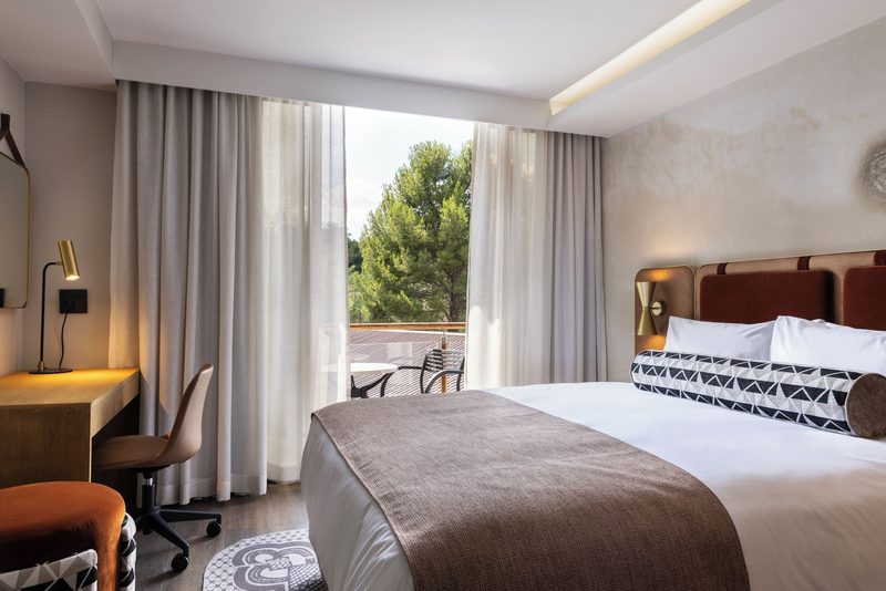
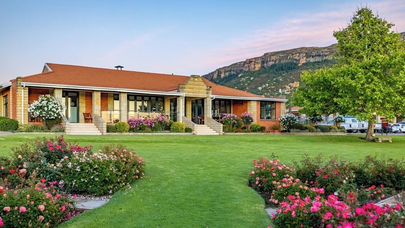
Where to Stay in Lesotho in October
Hand-picked hotels across price tiers for October travellers.
Public Holidays in October
Dates that affect opening hours, transport and crowds
Independence Day
Observed nationwide as a public holiday.
Independence Day
Observed nationwide as a public holiday.
Independence Day
Observed nationwide as a public holiday.
Packing Checklist
Bookmark this page — your progress is saved between visits
Need the full list with shopping links?
Climate-specific gear, brand recommendations, and what to leave at home.
View Lesotho Packing List →Essential Tips
Insider knowledge and common pitfalls to avoid
Insider Knowledge
Learn even a handful of Sesotho greetings. It changes everything. Lumela for hello, khotso for peace, ke a leboha for thank you. Basotho people are warm but reserved with strangers who speak only English, and a greeting in Sesotho breaks through that reserve in a way nothing else does. In rural areas, greeting everyone you pass on a path is not optional politeness but expected social behaviour. Walking past someone without a word is considered rude, and a silent hiker will find doors that would otherwise open staying closed.
Cross the border at Maseru Bridge rather than the smaller crossings like Caledonspoort or Van Rooyens Gate unless you specifically need the northern route. Maseru Bridge has the most predictable hours, the shortest queues in October outside of South African public holidays, and immigration officers accustomed to processing tourists. Have your passport, not a photocopy, and expect the process to take anywhere from fifteen minutes to an hour depending on the day and whether the computer system is cooperative.
Lesotho's safety profile splits between urban and rural. Maseru has petty crime typical of any southern African city: do not walk around after dark with visible valuables, keep car doors locked, and avoid the industrial areas south of the city centre at night. The highlands are a different reality, where the main risks are exposure, altitude, and road conditions. Herd boys tending cattle in remote valleys are more likely to offer you fermented maize drink than cause trouble. That said, do not hike alone in unfamiliar highland areas without a local guide who knows the terrain and the weather patterns.
Fuel up in Maseru before heading into the highlands. Petrol stations thin out dramatically past Thaba-Tseka, and the ones that exist may be dry for days at a time. Carry a jerry can if you are driving the route between Katse Dam and Mokhotlong. Mobile phone signal drops to nothing across large sections of the highlands. Vodacom Lesotho has the best rural coverage. But expect dead zones in the deeper valleys that can last hours of driving.
Avoid These Mistakes
Underestimating the altitude. Lesotho is the only country in the world where every point sits above 1,000 m (3,281 ft), and large portions of the highlands are above 2,500 m (8,202 ft). Travelers arriving from sea-level South African cities like Durban or Cape Town sometimes push straight into strenuous highland hikes and hit altitude-related headaches, nausea, and breathlessness by midday. Spend at least a night in Maseru at 1,600 m (5,249 ft) before heading higher, drink far more water than you think you need, and accept that you will move slower than usual for the first couple of days.
Assuming Lesotho's roads are like South Africa's. The paved A-roads between major towns are narrow, potholed, and shared with pedestrians, livestock, and overloaded minibus taxis that overtake on blind corners with a confidence that defies survival instinct. Secondary roads to places like Semonkong and Katse Dam are unpaved and become slippery after October's afternoon rains. A two-wheel-drive rental car from South Africa will leave you stranded. Budget for a 4x4, and budget considerably more time than mapping software suggests for every drive.
Trying to cover too much in too few days. Lesotho is roughly the size of Belgium. But road conditions mean that a straight-line distance of 100 km (62 miles) can take three or four hours of actual driving, sometimes longer after rain. Travelers who plan Maseru, Katse Dam, Semonkong, and Sani Pass in five days spend most of their trip grinding along rough roads in the dark behind their own headlights. Pick two highland destinations and give each at least two nights, or accept that the driving itself, through some of the most dramatic mountain scenery in southern Africa, is the experience and let the pace slow accordingly.
Ready to plan your trip to Lesotho?
Now that you've got the research covered, here's where to go next.
Explore More Activities in Lesotho
Didn't see anything interesting yet?
Browse Viator's full catalog of tours, day trips, food experiences, and private guides in Lesotho.
See All Lesotho Tours on Viator